Boston has undergone many changes. Where did Broadway go?
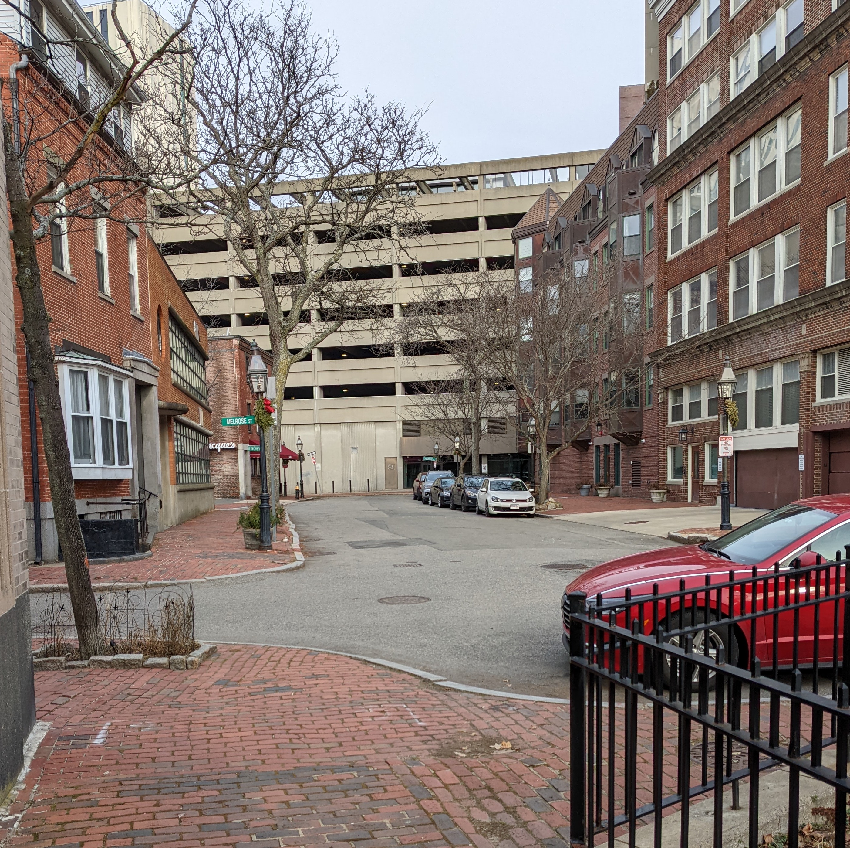
There’s a street in Boston called Broadway, but it doesn’t look like what you’d expect. It’s a quiet side street, about 200 feet long. This is the view down the length of it:

What is going on? How did such a tiny thing get named Broadway? It turns out, the better question is, how did Broadway become such a tiny thing?
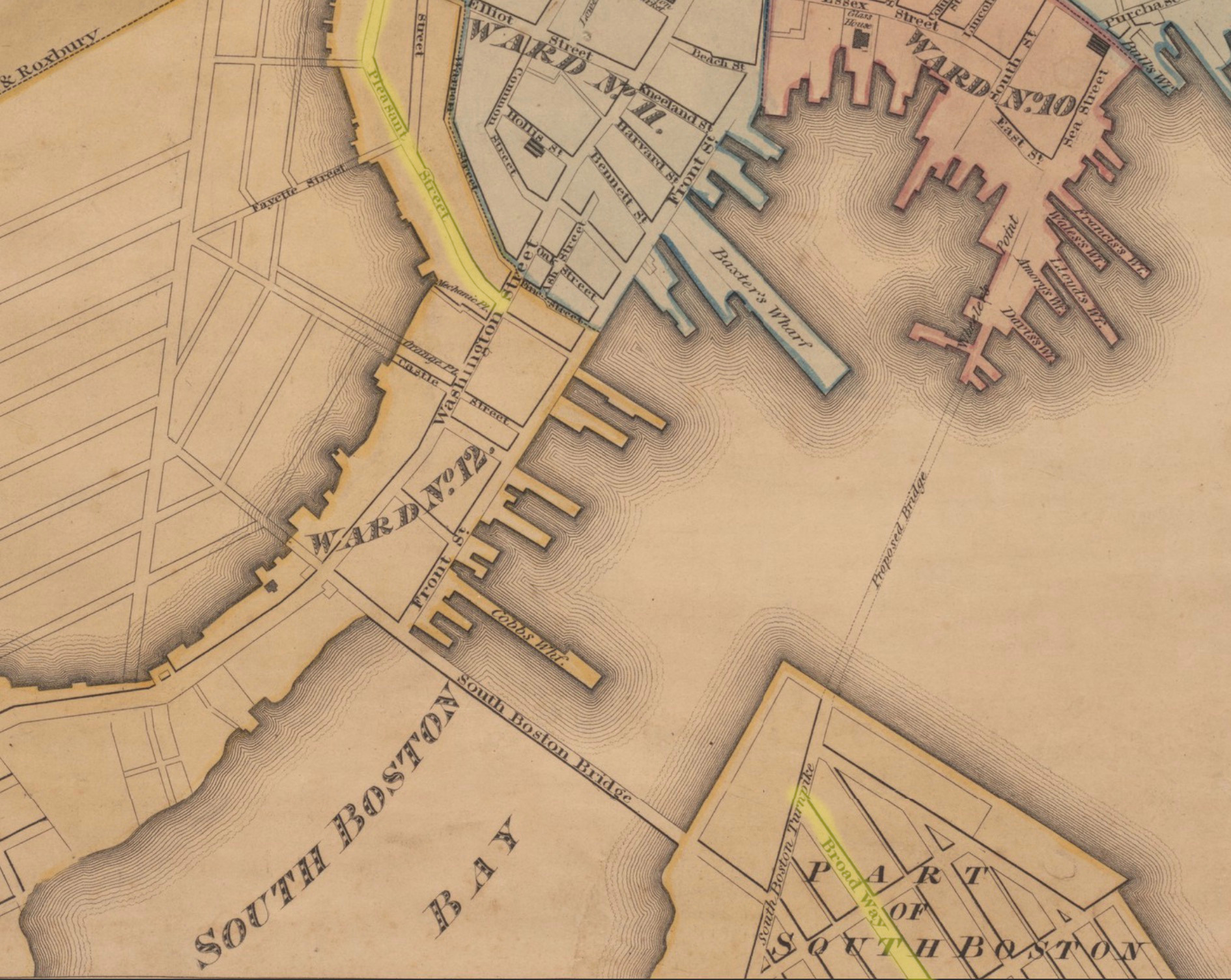
Like many cities, and probably more than most cities, Boston has undergone enormous change. When first settled in 1630, it was nearly an island, connected to the mainland by a narrow isthmus.
This 1826 map of Boston shows two streets relevant to our mystery, highlighted in yellow: Pleasant Street at the top heading up to Boston Common, and Broadway, part of South Boston at the bottom:
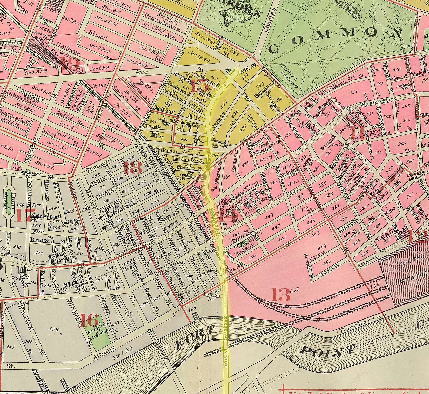
By 1917, much of the surrounding water has been landfilled (the 1826 map shows some planned streets), and Broadway from South Boston now runs into Pleasant Street, continuing up to Boston Common:
By 1938, Pleasant Street had been renamed, so the entire street from South Boston to Boston Common is now a major street named Broadway.
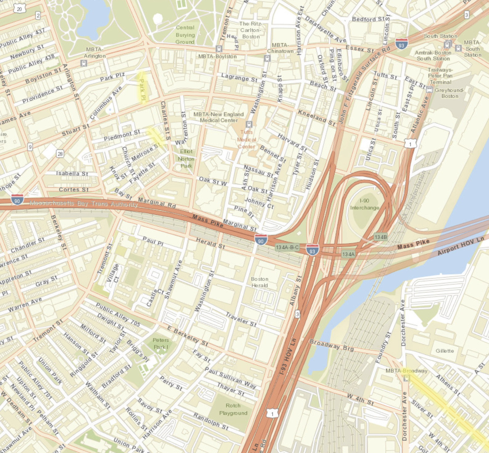
Some time in the 1970’s, after the extension of the Mass Pike to I-93, this part of Boston had a massive restructuring. Today it looks like this:

Broadway is still a major street in South Boston at the bottom, but all that remains of the street in Boston proper is a small piece now called Park Place near Boston Common at the top, and our 200-foot street still named Broadway just below that. Refactoring a city can leave you with some strange little remnants.
Just to make it more confusing, of the three(!) street signs on the street, two say “Broadway”, and one says “Broadway St,” which doesn’t even make sense...
BTW, sorry for the changing scale and orientation in these maps. If you want to explore maps over time in a less disorienting way, mapjunction.com is fabulous.


Comments
Add a comment: